
University of Twente Pits VGGT and DUSt3R Against COLMAP on Drone Imagery
Researchers benchmarked COLMAP against ten learning-based 3D reconstruction models on aerial imagery, revealing where transformers beat classical pipelines and where they still struggle.
 Pro
Takeaways
- University of Twente team benchmarks COLMAP against 10 learning-based MVS methods on aerial drone imagery.
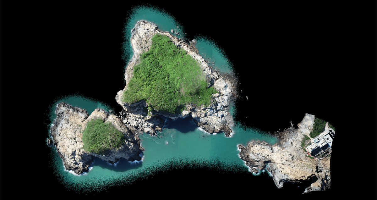
- COLMAP reaches 1326s runtime on 100 island images; VGGT finishes the same job in ~60s.
- DUSt3R wins sparse-view accuracy (2.88 GSD RMS with 2 images) but degrades sharply with more views.
- VGGT delivers the best overall balance of runtime, accuracy, and coverage across view counts.
- Geometry-guided methods (MVSFormer++, MVSAnywhere, PatchmatchNet) inherit COLMAP failures since they need its poses.
- End-to-end transformers still show layering artifacts on vegetation, rock, and water surfaces. Read the paper.
Photogrammetry has been dominated for years by a well-worn recipe: extract features, match them across views, run bundle adjustment, then fuse depth maps into a dense point cloud. That pipeline, embodied by tools like COLMAP, is accurate but slow. A wave of learning-based models promises to skip most of it and predict 3D structure directly from pixels. A new comparative study from the University of Twente puts ten of them head-to-head with COLMAP on drone imagery, and the results are less flattering to the neural side than the headlines suggest.
The paper evaluates a representative traditional pipeline (COLMAP) against two families of learning-based methods: geometry-guided approaches that still lean on classical camera poses (MVSNet, PatchmatchNet, MVSAnywhere, MVSFormer++), and end-to-end transformers that infer geometry directly from images (Stereo4D, FoundationStereo, DUSt3R, MASt3R, Fast3R, VGGT). The question is simple: can any of them replace COLMAP for aerial mapping today?
Why aerial imagery breaks the usual benchmarks
Most learning-based reconstruction models are trained and benchmarked on indoor scenes or ground-level captures, where baselines are wide and objects are close. Aerial photogrammetry looks very different. Photogrammetric aerial images consist of rather small baselines with mostly nadir views of relatively large scenes, leaving fewer of the perspective variations that DUSt3R, MASt3R, and VGGT typically process. Textures repeat across vegetation, rooftops, and water; scenes are huge; and resolution is punishing.