
Stanford's NAV Lab Beats 30 Teams in NASA's Lunar Rover Challenge
Stanford's NAV Lab took first place in NASA's Lunar Autonomy Challenge with a modular SLAM stack that hits centimeter-level accuracy in a GPS-denied simulated moonscape.
 Pro
Takeaways
- Stanford's NAV Lab won NASA's Lunar Autonomy Challenge, beating 30 teams including MIT and Harvard. NASA announcement
- Task: map a 27m x 27m lunar area at 15cm resolution using only cameras and IMU, no GPS.
- Stack combines U-Net++ segmentation, SuperPoint + LightGlue features, and GTSAM pose graph SLAM.
- Achieved centimeter-level RMSE (3.8-6.7 cm) across varied rock presets and random spawn locations.
- Path planner intentionally revisits regions to trigger loop closures and correct drift.
- Full source released at Stanford-NavLab/lunar_autonomy_challenge.
Autonomous driving on Earth leans heavily on GPS, HD maps, and LiDAR. Strip all of that away, drop the rover onto a textureless gray surface lit by shadows sharp enough to blind a camera, and you get the problem NASA handed 31 university teams in the Lunar Autonomy Challenge. A group from Stanford's NAV Lab just published the paper describing the system that won it, and the recipe is refreshingly classical: no end-to-end policy, no giant foundation model, just a well-engineered SLAM stack with learned features glued in at the right places.
The moon breaks most of your visual pipeline
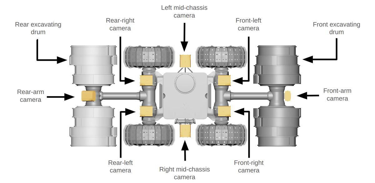
The NASA Lunar Autonomy Challenge is a six-month competition to virtually map and explore using a digital twin of NASA's In-Situ Resource Utilization Pilot Excavator (IPEx). Teams operate inside a high-fidelity simulator built with Unreal Engine and CARLA, and must map a 27m x 27m region around a simulated lander using the autonomous IPEx digital twin.
The environment is deliberately hostile to standard robotics stacks. There is no GPS. The terrain is unstructured and unseen. An absent atmosphere produces high-contrast shadows and blown-out highlights that wreck vision models trained on Earth imagery, and large stretches of regolith are texture-poor enough that traditional feature detectors struggle to find anything to track. The rover itself carries only an IMU and eight monochrome cameras arranged in front and back stereo pairs plus side and arm-mounted views.
Scoring is unforgiving. The map is a 180 x 180 grid at 15 cm resolution, and a cell only counts as correct if the estimated height is within 50 mm of ground truth. Rock detection is graded on F1 score. Miss the elevation by six centimeters, and the cell is wrong.

Modular beats monolithic
The Stanford team's answer, which they call NAV Lab, is a layered pipeline where each stage does one thing and hands off cleanly to the next. The five pieces are: