
Purdue's Diffusion Model Designs City Greenery to Hit Exact Cooling Targets
A Purdue team flips urban heat modeling on its head, using diffusion to design vegetation layouts that hit specific temperature targets.
 Pro
Takeaways
- Purdue team introduces a diffusion-based inverse model that designs urban vegetation layouts to hit specific temperature targets (paper).
- Framework couples a frozen U-Net forward LST predictor with an EDM diffusion generator supervised by a patch-mean physics loss.
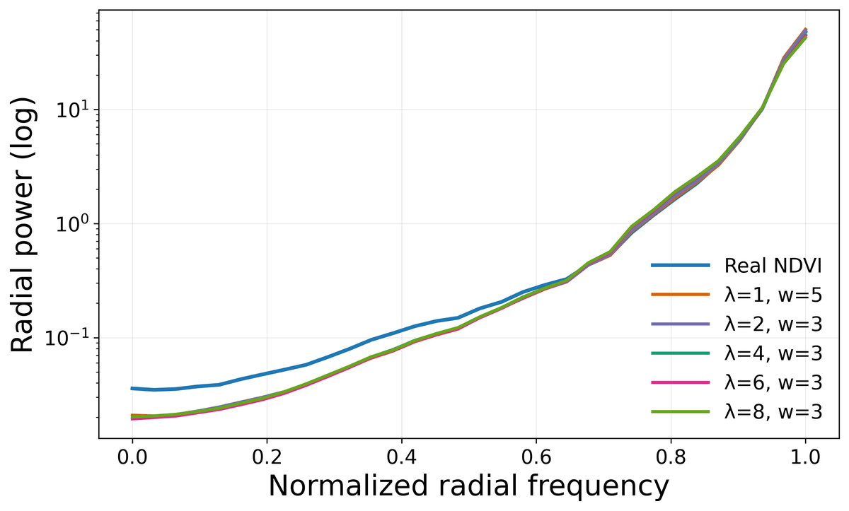
- Coarsening the LST conditioning by 32x is key: fine-resolution conditioning collapses diversity, coarsening restores it.
- Achieves 3.4x more diverse layouts and 37% lower specificity error than baselines across 20 US cities.
- Best configuration hits 0.56 C control error with SSIM diversity above 0.9 at guidance weight w=3.
- Accepted at the CVPR 2026 EarthVision Workshop; trains in ~4 hours on a single RTX 6000 Ada.
Predicting how hot a neighborhood will get from its greenery is a well-worn problem. The reverse question, far more useful for city planners, has barely been touched: given a target cooling of, say, 2 degrees Celsius, what vegetation pattern would you actually plant to get there? A team from Purdue University proposes a framework that treats this as a generative inverse problem and solves it with a diffusion model conditioned on a physics-aware forward predictor.
The paper, Conflated Inverse Modeling for urban vegetation, was accepted to CVPR 2026 EarthVision. The authors argue that while forward models can predict land surface temperature from vegetation and urban form, the inverse problem of determining spatial vegetation configurations that achieve a desired regional temperature shift is inherently underdetermined, since multiple layouts can yield similar aggregated temperature responses. That ambiguity is what breaks conventional regressors.
Why plain neural networks flatten the answer
Train a deterministic network to output a vegetation map given a temperature target, and it averages across all valid solutions, handing back a blurry, unrealistic mean. Conventional regression fails to capture the ambiguity, particularly under data-scarce conditions. The Purdue team quantifies it directly: even after grouping urban tiles into bins with similar building heights and land surface temperature (LST) profiles, NDVI configurations still vary by roughly 24 percent within a bin. The one-to-many nature of the problem is real, not a modeling artifact.
NDVI, the Normalized Difference Vegetation Index, is a satellite-derived measure of how much healthy greenery is on the ground. Higher values mean denser vegetation. LST is the surface temperature retrieved from thermal bands. The goal is to generate NDVI maps that, when passed through a forward physics-aware model, produce a target LST change over a chosen region.