
DPNet Cuts Robot Navigation Failures by 30% Using Velocity-Aware LiDAR
A new planner fuses Doppler LiDAR velocity readings with a learned Kalman filter and self-tuning MPC to dodge fast-moving obstacles.
 Pro
Takeaways
- DPNet is the first motion planner to integrate Doppler LiDAR's per-point velocity readings into closed-loop control (paper).
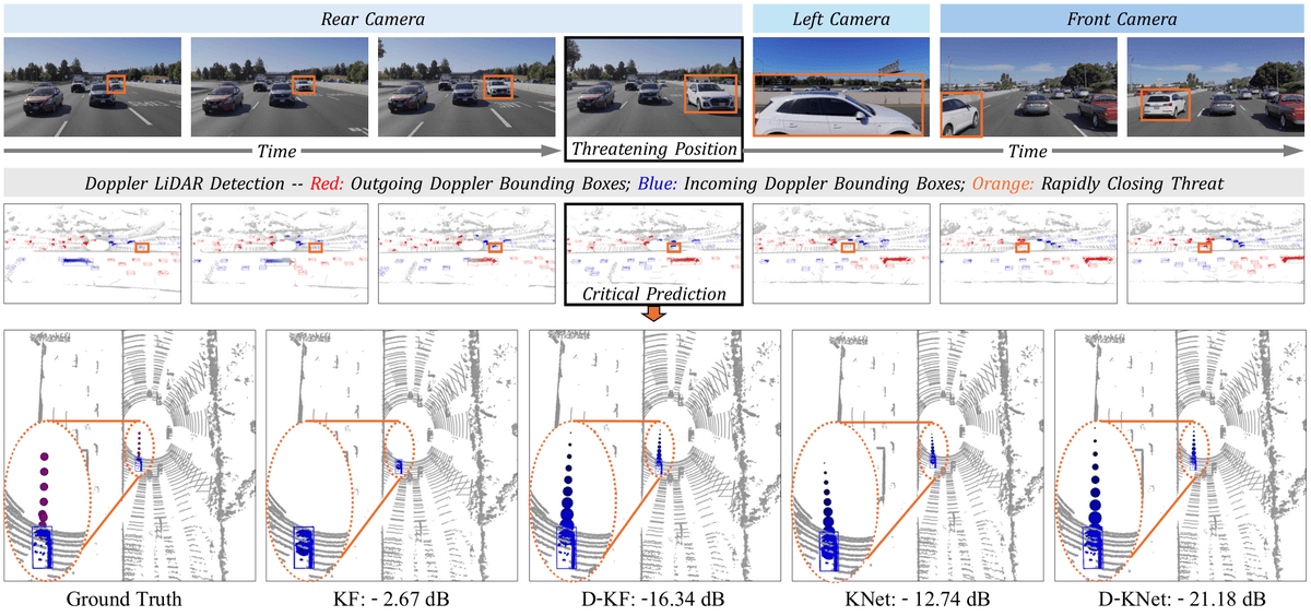
- D-KalmanNet learns the Kalman gain via a small RNN, cutting tracking error by over 10 dB versus prior methods.
- DT-MPC auto-tunes safety distance at runtime using imagined collisions instead of waiting for real crashes.
- Pass rate on 7-obstacle DynaBARN scenarios: 45 percent vs. 30 percent for RDA, 2 percent for OBCA.
- Runs at 15-100 Hz on NVIDIA Jetson Orin NX with only 107 MB GPU memory, tracking up to 10 obstacles.
- Code and experiments available on GitHub; real-world evaluation uses the AevaScenes dataset.
Robots navigating traffic, warehouses, or rescue sites have one persistent weakness: they see where things are, but not how fast those things are moving right now. A new paper from researchers at the University of Hong Kong, Shenzhen Institutes of Advanced Technology, and the University of Macau wires a motion planner directly into a Doppler LiDAR, the newer class of sensor that returns per-point velocity alongside range.
The result is DPNet, or Doppler Planning Network, which the authors claim is the first attempt to integrate Doppler LiDAR with closed-loop motion planning. In their experiments, it cuts navigation time by 6 to 30 percent, raises success rate by up to 16 percent, and reduces tracking error by over 10 dB against benchmark schemes. Code is on GitHub.
Why standard LiDAR planners crash
Existing motion planners lean on LiDAR to capture obstacle positions from the point cloud, then predict future trajectories with learning-based, physics-based, or physics-informed methods. None of those approaches actually observe velocity. They infer it by differencing positions across frames, which is noisy and lags reality. When an obstacle is moving at highway speeds or changing direction abruptly, that lag is where collisions happen.
Doppler LiDAR, sometimes called FMCW LiDAR, measures the radial velocity of every returned point directly using the frequency shift of the laser. In the Carla simulator, the authors show a scenario with two static and two rapid-motion obstacles at 5 m/s where a standard planner (RDA) drives into the gap between the moving obstacles and crashes, while DPNet uses velocity information to predict the trap and turns left early.