
AnyVisLoc Benchmark Exposes How Badly Drones Navigate Without GPS
A CVPR 2026 benchmark with 18,000 drone images tests every major visual localization method on the hardest angles and altitudes drones actually fly.
 Pro
Takeaways
- New CVPR 2026 benchmark tests UAV visual localization under low-altitude oblique views where existing methods fail.
- AnyVisLoc dataset contains 18,000 drone images from 7 DJI models across 15 Chinese cities.
- Best pipeline (CAMP retrieval + RoMa matching + Top-N re-rank) achieves 74.1% accuracy within 5 meters.
- Satellite reference maps drop accuracy to 18.5% due to coarse 30m DSM and temporal drift.
- New PDM@K retrieval metric better predicts downstream localization accuracy than Recall@K.
- Demo code and 1/25 dataset released; full paper details what still breaks.
When a drone loses GPS, it has to figure out where it is by looking. That means matching what its camera sees against a geo-tagged reference map, then solving geometry to recover the exact position. The approach works reasonably well when drones fly high and look straight down. It breaks in the regime where most consumer and commercial drones actually operate: below 300 meters, tilted at oblique angles, over buildings, farmland, and mountains. A new benchmark from researchers at the National University of Defense Technology, accepted to CVPR 2026 Findings, is the first attempt to systematically measure how badly current methods break, and which combinations recover the most.
The blind spot in drone localization
The paper focuses on Absolute Visual Localization (AVL), which pins a drone to a geo-tagged reference map rather than tracking motion frame to frame like SLAM. Because AVL matches each frame independently against a fixed map, it has inherent immunity to drift, which is why it matters for long flights where inertial navigation wanders and GPS may be jammed or spoofed.
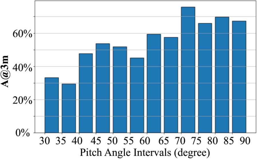
Most prior work assumes a nadir view: the camera points straight down and the scene is treated as roughly flat. That assumption falls apart at low altitude. When a drone at 50 meters tilts to 30 degrees, rooftops, trees, and terrain generate strong parallax and side views that no ortho-rectified map contains. The similarity metrics commonly used for template matching, such as NCC and MI, are not invariant to viewpoint differences, making them poorly suited to low-altitude, multi-view conditions. Existing datasets either use synthetic imagery, cover only nadir views, or lack the ground-truth positions needed for precise evaluation.