Google DeepMind's WeatherNext Cyclones Gives Forecasters an Extra Day to Save Lives
Google DeepMind's WeatherNext achieves a decade of forecasting progress in one leap, now open-sourced with 1,000-scenario ensemble predictions per storm
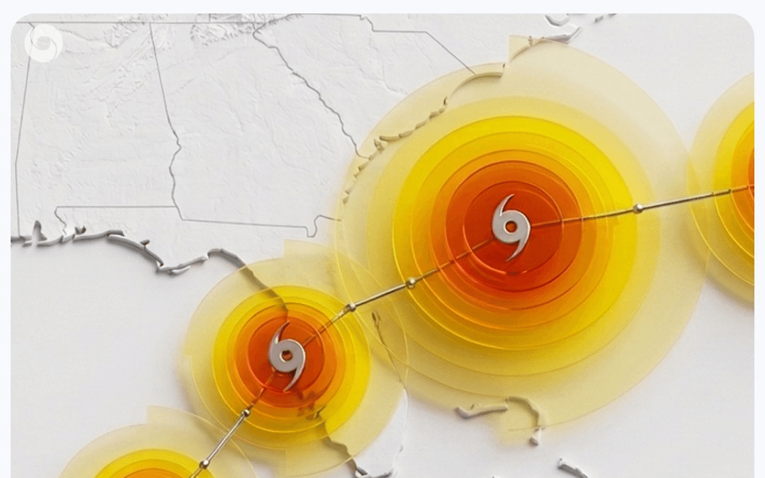
- Nature paper published: WeatherNext Cyclones achieves state-of-the-art accuracy in cyclone track, intensity, and wind structure — equivalent to a decade of forecasting progress.
- +24 hours of lead time: 3-day forecasts now match the quality of prior models' 2-day forecasts, on average across all three forecast dimensions.
- Open-sourced: Code and model weights for WeatherNext Cyclones, WeatherNext 2, and WeatherNext 2-mini are freely available on GitHub.
- 1,000-scenario ensembles: Each 15-day forecast scenario runs in under a minute on a TPU; this season forecasters get 1,000 probabilistic scenarios per storm via WeatherLab.
- Hurricane Melissa proof point: WeatherNext predicted Category 5 landfall in Jamaica 5 days in advance — the NHC's first-ever forecast of a storm going from Cat 1 to Cat 5 before landfall.
- Resolution surprise: The model achieves top intensity accuracy at 28km resolution, 100x coarser than traditional models, challenging a core assumption in the field.
Tropical cyclones have killed more than 700,000 people and caused $1.4 trillion in economic losses over the past 50 years. The core problem for forecasters has always been time: every hour of additional warning translates directly into lives saved. Google DeepMind has published a paper in Nature showing that its WeatherNext Cyclones model achieves state-of-the-art accuracy in predicting a storm's track, intensity, and wind structure, and is now open-sourcing the code and model weights for anyone to build on.
A decade of progress in one model
On average, WeatherNext gives forecasters an extra day of predictive accuracy: three-day forecasts are as accurate as what prior models could produce for only the next two days. That improvement corresponds roughly to a decade of meteorological progress, the kind of leap that changes how emergency managers plan evacuations.
The benchmark numbers back this up. The FGN ensemble mean track position error is significantly lower than GenCast's, offering approximately a 24-hour accuracy advantage at 3–5.5 day lead times. That advantage holds across all three dimensions of a cyclone forecast:
- Track: where the storm goes
- Intensity: how strong it gets, measured in knots
- Wind structure: the spatial extent of damaging winds
The National Hurricane Center's annual verification report confirmed WeatherNext as the top-performing individual model for both track and intensity throughout the 2025 hurricane season.
The trade-off it eliminates
For decades, cyclone forecasting forced a painful choice. Models consistently excelled at predicting a storm's path or its intensity, but rarely both at once. Large global models tracked storms well yet lacked the granular detail to capture the small-scale atmospheric processes behind rapid intensification. High-resolution local models could catch intensity changes but often lost broader contextual accuracy.
WeatherNext handles both in a single model, predicting global atmospheric patterns and fine-scale cyclone behavior end-to-end through a combination of its training data, architecture, and approach to low-resolution inputs.
How Functional Generative Networks work
The key architectural innovation is the Functional Generative Network (FGN). Ensemble forecasting generates many plausible future weather scenarios rather than a single prediction, which lets forecasters quantify uncertainty and identify rare but catastrophic outcomes like rapid intensification. Previous approaches, including the diffusion models used in GenCast, were accurate but slow to sample from.
FGN injects noise directly into the model architecture so that each generated forecast stays physically realistic and internally consistent. The training strategy is where things get interesting. FGN is trained only on "marginals," meaning the forecast distribution at each individual location and variable in isolation. Despite never being trained on "joints," the way variables across space combine into coherent structures like cyclones, fronts, and heat waves, the model still captures that joint spatial structure when sampled.
In plain terms: the model learns to predict each location's weather independently, yet when you sample from it, physically coherent storm systems emerge automatically. WeatherNext 2 achieves better CRPS (a standard probabilistic accuracy metric) than the earlier GenCast-based model on 99.9% of variable, level, and lead time combinations, with average improvements around 6.5%.
The resolution surprise
The model was co-trained on two data sources: global weather dynamics and expert-curated historical cyclone observations. Training end-to-end on nearly 20 terabytes of global atmospheric data and the IBTrACS database of nearly 5,000 historical storms lets the model learn both broad atmospheric patterns and the behavior of extreme weather events.
One finding that surprised the researchers: WeatherNext Cyclones only needs input data at 28km resolution, 100 times coarser than traditional high-resolution models. A smaller variant, WeatherNext 2-mini, operates at an even coarser 111km resolution and still performs well. Why the model produces such accurate predictions at this resolution remains an open research question the team is explicitly inviting the community to investigate.
Hurricane Melissa: the real-world test
In October 2025, Hurricane Melissa became the strongest hurricane on record to make landfall in Jamaica and tied for the strongest Atlantic hurricane ever recorded. For the first time in NHC history, forecasters predicted a storm would reach Category 5 intensity starting from Category 1 wind speeds. WeatherNext supported that decision by predicting the storm's rapid intensification and Jamaica landfall with high confidence, five days in advance.
Rapid intensification, when a storm jumps multiple categories in under 24 hours, is notoriously hard to predict because it is driven by small-scale thermodynamic processes that coarse global models miss. WeatherNext caught it early enough to matter.
From 50 to 1,000 scenarios per storm
Each 15-day probabilistic forecast scenario runs in under a minute on a TPU. That speed is what makes scaling the ensemble from 50 members last season to 1,000 this year practical.
Ensemble size matters because more scenarios give better coverage of the tail of the distribution, the rare, worst-case outcomes most critical for emergency planning. This year, 1,000 probabilistic predictions per storm are being provided to forecasters through WeatherLab. The model already powers weather forecasts across Google Search, Maps, and Pixel devices.
What's open-sourced and how to use it
The code and model weights are being released on GitHub for academic research, operational forecasting, or building more specialized regional models. Three variants are available:
- WeatherNext Cyclones: the model that ran operationally during the 2025 hurricane season and is benchmarked in the Nature paper
- WeatherNext 2: an updated version operationalized in October 2025
- WeatherNext 2-mini: a compact version that runs on a single TPU, available in a free public Colab notebook
The mini version is the most accessible entry point for researchers without TPU clusters. You can run it directly in Colab:
# WeatherNext 2-mini demo (runs on a single free TPU in Colab)
# https://colab.research.google.com/github/google-deepmind/weathernext/
#        blob/master/docs/weathernext2/wn2_demo.ipynb
import weathernext
# Load the mini model checkpoint
model = weathernext.load_model("weathernext2-mini")
# Run a 15-day ensemble forecast from ERA5 initial conditions
forecasts = model.predict(
    init_time="2025-10-21T00:00:00",  # Hurricane Melissa genesis
    ensemble_size=50,
    lead_days=15
)
# forecasts.shape -> (50, 60, lat, lon, variables)
# 50 scenarios x 60 6-hour steps x spatial grid x weather variables
WeatherNext 2 forecast data is also available in Earth Engine and BigQuery, and an early access program is launching on Google Cloud's Vertex AI platform for custom model inference. Weather Lab has been refreshed with a new interface and expanded to include global weather forecasts alongside cyclone tracks, letting you visualize WeatherNext predictions for temperature, precipitation, wind speed, and more in a single view.
Where the field goes from here
AI weather forecasting has moved fast. GraphCast (2023) beat ECMWF's deterministic model. GenCast (2024) beat the ensemble. WeatherNext Cyclones now beats both on the hardest sub-problem, cyclone intensity, while running 1,000-member ensembles in real time. Google's collaboration with the NHC is already expanding to the Philippines, Taiwan, Indonesia, and Vietnam.
The resolution finding is the assumption most worth revisiting. High spatial resolution has long been considered the primary driver of accurate intensity forecasts. WeatherNext achieves state-of-the-art intensity prediction at 28km, 100 times coarser than what traditional models use. If that holds across more storms and basins, the field may have been over-investing in resolution at the expense of better training data and architecture.
Comments