
Extreme heat kills an estimated 500,000 people every year, and cities bear the worst of it. Urban heat islands -- areas where roads and buildings absorb and re-emit heat -- cause cities to warm at twice the global average rate. Google Research just made a significant move to help city planners fight back: it has expanded its Heat Resilience dataset from 14 pilot cities to 50+ cities across 9 countries, backed by a peer-reviewed paper in Nature Communications and a new free interactive mapping tool.
From pilot to planet
The story starts in 2024, when Google piloted the Heat Resilience approach with 14 U.S. cities. Miami-Dade County used it to develop policies that incentivize developers to take heat mitigation measures. Stockton used an earlier version to gather data for potential projects and opportunities to reduce urban heat islands. The results were promising enough to justify a full global push.
Now the dataset covers major urban centers across Europe, Brazil, and the United States. New additions include London, Athens, Barcelona, Rio de Janeiro, São Paulo, Los Angeles, Austin, and New York City. The data is free, open, and accessible today through the new Heat Resilience Earth Engine App.
The resolution problem they had to solve
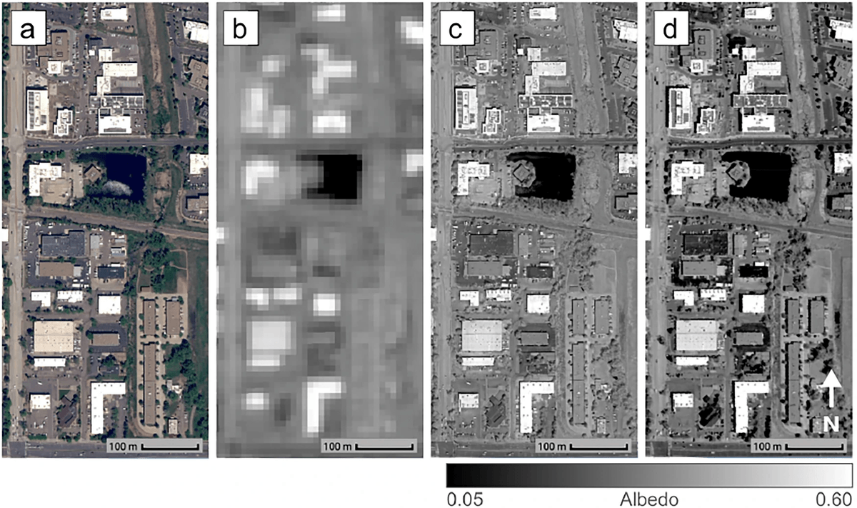
The core technical challenge here is a familiar one in geospatial ML: freely available satellite data is too coarse to be actionable. Sentinel-2 albedo estimates are freely available globally, but their 10-meter spatial resolution is insufficient to resolve individual rooftops. A 10-meter pixel averages over an entire building, a parking lot, and a patch of grass -- useless for targeting a specific roof for a cool-roof retrofit.


Don't miss what's next in AI
Join 300,000+ engineers and researchers who get the signal, not the noise.
- Full access to in-depth AI research breakdowns
- Be the first to know what's trending before it hits mainstream
- Daily curated papers, repos, and industry moves